Point Reyes
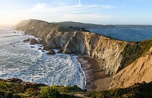
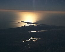
Cape in Northern CaliforniaPoint Reyes is a prominent landform and popular tourist destination on the Pacific coast of Marin County in Northern California. It is approximately 30 miles (50 km) west-northwest of San Francisco. The term is often applied to the Point Reyes Peninsula, the region bounded by Tomales Bay on the northeast and Bolinas Lagoon on the southeast. The majority of the peninsula as well as the headlands are protected as part of Point Reyes National Seashore.
Read article
Top Questions
AI generatedMore questions
Nearby Places

New Albion
Part of modern California claimed for England by Francis Drake

Drakes Bay
Bay on the coast of California, U.S.

Drakes Estero
Lagoon in California, United States

Point Reyes Lighthouse
Lighthouse in California, United States
Rancho Punta de los Reyes Sobrante
Mexican land grant in California, US

Point Reyes Lifeboat Station
United States historic place

Labouchere (paddle steamer)


